 |
| See the moon setting over the mountain? So pretty! |

 |
| Bezekelike Buddhist Grottoes |
 |
| One of the frescoes |
 |
| We LOVE reading Chinese translations into English! |
Look at the snow-capped mountains in the background! The views were lovely, especially after our smoggy, polluted surroundings in Chengdu.
Driving back to the ancient city of Gaochang, we saw more interesting sights. I wish I had my camera ready when we saw a full cow being dissected on the patio of a home, with all the entrails, and the skin, and the head, spread out with the men surrounding it, chopping things up.
 |
| Muslim Cemetery with tombs |
 |
| Peppers out to dry in the sun |
 | |
| Festivities at a Uighur home during a wedding |
 |
| Uighur home where you can see the bed on the roof because it's too hot to sleep inside in the summer. |

 |
| Too bad you can't see that we are trotting along in this picture! |


 |
| Sitting lotus-style for the missing Buddha. |


The Chinese are trying to preserve their history and cultural relics. So much was destroyed during the Cultural Revolution, so it's very commendable what they are doing.
The muslim Mazar Village in the Tuyugou Valley is the second-most holy site in Islam. A person making two (or another guide said seven) pilgrimages to this village is equal to those who go to Mecca on their Haj. We walked through the town looking at the villagers and homes and local mosque, then to the "Tomb of the Seven Saints". These holy men who were seeking enlightenment fell among evil people and were taken to a cave by a shepherd to protect them for the night. They went to sleep, but woke up 309 years later! More interesting sights and stories.
 |
| A woman making noodles--not knitting! |
 |
| A Uighur woman and daughter in their home. |
 |
| The prettiest home I saw in Xinjiang! No front wall! |
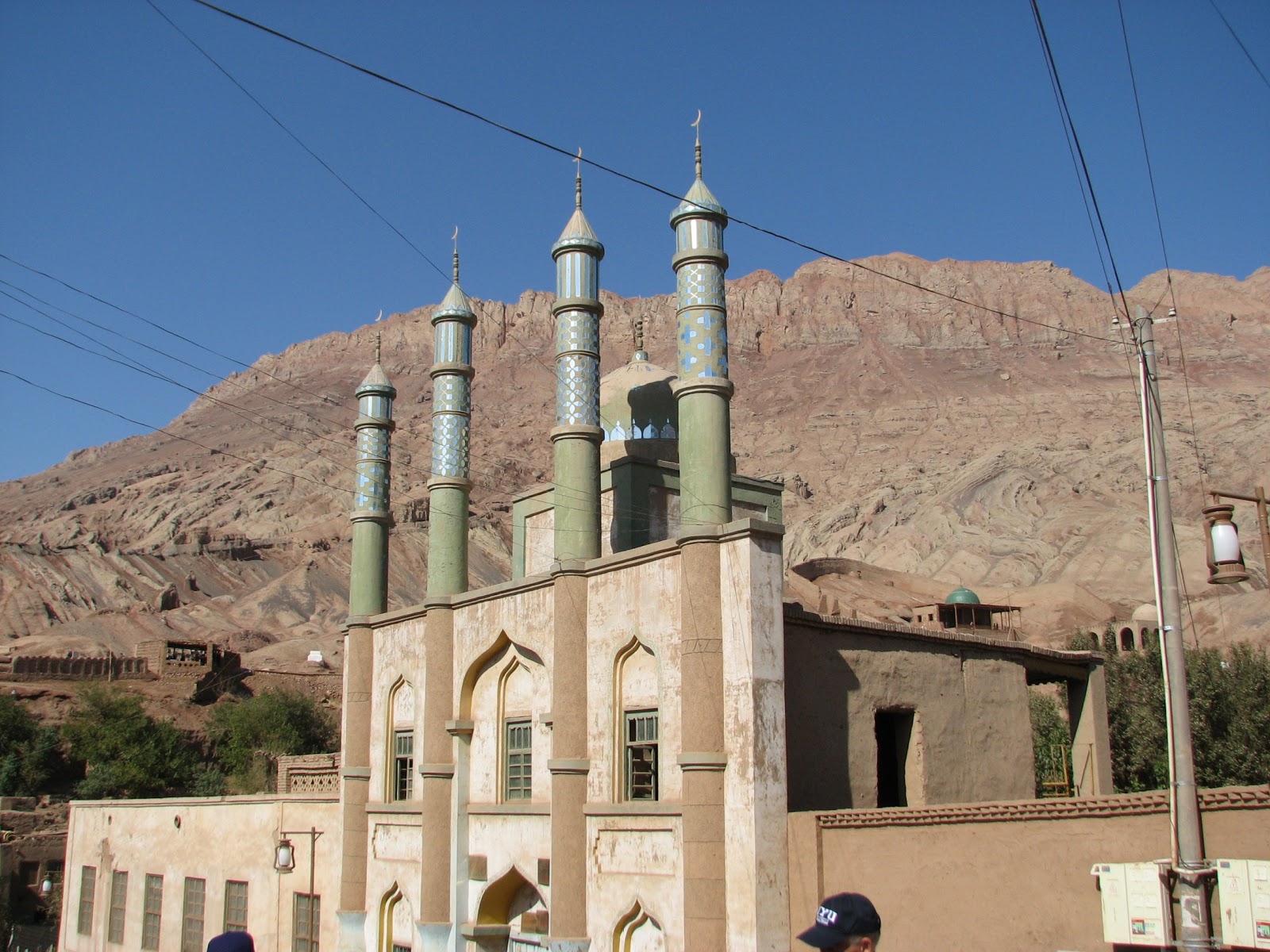 |
| The town mosque. |
 |
| A view to the caves in the mountain. |
We drove back to town through the "Grand Canyon of China"! Not quite like ours in Arizona!


 | ||
| It feels about as soft as the one in Chengdu! |


Excuse me, but is this where they dried those raisins I bought today? Along the sidewalk at the Minaret? Actually, we saw many little brick 'drying houses' as we drove along which they use most of the time. But I guess if you have a bountiful harvest, you use whatever space you can. (Maybe I ought to dust off my raisins before I eat them!)
We drove out to the train station to await our "Soft Sleeper Train" which was to be our overnight accommodations. Go to sleep in Turpan, wake up in Dunhuang! Seems easy enough--just like my semester abroad days in college. As we waited in the VIP lounge with our 50+ BYU Teacher's Group, we all took turns trying to figure out just what this sign was trying to say. Any guesses?

 |
| Our fellow BYU teachers and "dorm" mates in Chengdu, Don & Marian Mason. |
No comments:
Post a Comment